Dive into the rich history of the River Teign, located in the beautiful county of Devon, England. Discover the stories that have shaped this iconic waterway and its impact on the surrounding landscape.


the River Teign's role in trade and industry, from its importance as a bustling port in centuries past to its contribution to the growth of nearby towns and villages. the remnants of ancient settlements that once thrived along its banks and explore the architecture that showcases centuries of human endeavor.  explore the captivating history of the River Teign in Devon.

The North and South Teign rivers in Devon, England, have a rich and ancient history that captivates historians. These rivers serve as living witnesses to the past, offering invaluable insights into the region's development over centuries.


The North Teign River, winding its way through Dartmoor National Park, reveals traces of human habitation dating back thousands of years. The hills and valleys surrounding the river bear evidence of prehistoric settlements, including ancient stone circles and burial mounds. Exploring the North Teign River unveils a tapestry of Celtic, Roman, and medieval influences, showcasing the remarkable continuity of human presence in this picturesque region.


On the other hand, the South Teign River courses through the dramatic landscape of Teign Gorge, providing glimpses into its fascinating past. From the remnants of Iron Age forts to the ruins of medieval castles, historical artifacts abound along the river's path. Historians are captivated by the tales of battles fought, civilizations risen and fallen, and the enduring spirit of the people who have called these riverbanks home. Discovering the ancient past of the North and South Teign rivers in Devon is a journey every historian cherishes.

At Fernworthy itself is a circle of upright stones and the remains of several stone rows sorely mutilated for the construction of a newtake wall. In a tumulus near these monuments was found an urn containing ashes, with a flint knife, and another, very small, of bronze or copper, and a large polished button of horn.On Chagford Common,near Watern Hill, is a double pair of rows leading from a cairn and a small menhir, to blocking - stones. Although the stones of which they are composed are small, the rows are remarkably well preserved .It will repay the visitor to continue his ascent of the South Teign to the Grey Wethers , two circles of stone, of which, however, many are fallen. Here exploration, such as has been conducted at Fernworthy circle, shows that the floors are deep in ashes, and this leads to the surmise that the circles were the crematories of the dead who lie in the cairns and tunnels in the neighbourhood.Near the source of the North Teign is Teignhead House , one of the most solitary spots in England.

A shepherd resides there, but it is not for many winters that a woman can endure the isolation and retain her reason.

According to Wace and Layamon,

in the time of  King Arthur  circa 6th century  Cador , Earl of Cornwall , pursued Childric the Saxon Kaiser and his troops as they fled towards their ships ,  which were moored (apparently) off Teignmouth Beach. Cador overtook them on the banks of the Teign. The churls, armed with “bats” and pitchforks, slew a large number of the Saxons and “then saw Childric that it befell to them evilly; that all his mickle folk fell to the ground; now he saw there beside a hill exceeding great; the water floweth thereunder that is named Teine; the hill is named Teinewic ; thitherward fled Childric with his four and twenty knights ... and Cador heaved up his sword and Childric he slew ... in the Teine water he perished.”


It seems very likely that the hill mentioned was the Ness, which was once known as Bryn Maur, or the great hill, and the battle probably took place on Shaldon sands.

The crossing from Shaldon to Teignmouth and the ferry dues were part of the perquisites of the Earl of Cornwall (who also called himself King of the Romans, a title dating from King Arthur’s day) in the 11th century a .d ., and it is probable that Cador gained these as part of the spoils of battle. By the middle of the 7th century a .d ., the valleys of the lower Exe and the Creedy were occupied by Saxons, and the Britons (as the Celtic and Mediterranean peoples called themselves) lived more or less amicably with them in the town of Exeter, but Devon was still predominantly Celtic and was ruled by a Celtic monarch. At this time, Bishop Honorius of Canterbury settled the boundaries of the land and fixed parishes. Taintona probably received official recognition. The parish of St. Nicholas was designated at Bryn Maur (Celtic for “Great Hill”) now corrupted into “Ringmore.” Taintona was probably not called by that name in those days, as “ton” or “tun” is a Saxon word for a settlement, and means a fencible place. It was, however, a fortified village. In 682 a .d ., Centwine, the Angle, “drove the Britons of the west as far as the sea, at the sword point”. This seems to indicate a more determined Anglo-Saxon invasion of Devon and an attempt to push the Celts further west. Assuming the Exe to be in the hands of the Saxons, the sea mentioned is probably the natural boundary made by the river Teign. It is probable that the Saxons took over Taintona and gave it a name in their own tongue, while the Celts moved across the river. The old hillside lookout above the Teign now fulfilled another purpose; that of a Celtic spyhole against the Saxons. In 800 a .d ., Egbert made another attempt to extend the Saxon rule in Devon, but at this time the Saxons themselves were being harried. Another race of marauders was sweeping down on Britain. These were the Danes. Now began a time of fear. The Saxon settlers complained that the sea, formerly their friend, was now

their enemy ;


Countless ages ago, the earth threw up the molten rock which was to become Dartmoor, the backbone of the County of Devon.

Convulsive movements raised and lowered the land, so that the great rock mass became part of a vast continent which included the land which we now call France.

Then the sea rushed in, filling the depression which was to become the English Channel and making islands of the rocky promontories of the Continental coasts. Movements continued intermittently over thousands of years, and masses of sand, silt and pebbles were laid down around the rock mass.

The ice ages came and went and, although they did not reach as far south as the embryonic Dartmoor, snow-slips which preceded the glaciers carried debris which was scattered over the Moor as “clitters.”

In warmer intervals between the centuries of ice, there were great floods of rain, which weathered and split the great rock plateau and rushed down from the high land in steep, stormy torrents - the beginning of the Taw, the Torridge, the Plym, the Dart and the Teign.

The Teign carried with it thousands of tons of rotted granite, which it laid down in its lower reaches as boulder clay. It cut for itself a narrow course through the softer rocks below the Moor and eventually poured into the sea through a sunken valley which we now call the Teign Estuary.

At the mouth of the valley, the current of the river, checked by the sea and by broken rocks, silt and sand, built up an area of beachy mud. The river, deflected by this barrier, took a sharp turn to the right and cut a way for itself at the foot of the great cliff which we now call the Ness.

The heaving crust of the earth had now become more stable.

Life had established itself on the land and the brown bear, the mammoth and the sabre-toothed tiger were wandering over the countryside, hunting, and being hunted by, primitive man.

The caves at Brixham and Torquay show traces of man’s habitation and there are signs that wild beasts lived there too.

No doubt Palaeolithic man hunted over the hills around Teignmouth and fished in the Teign, but there is no record of inhabited caves in or near Teignmouth.

Thousands of years later,

Bronze Age man lived on Haldon and he regarded the shores of Teignmouth as a good place to obtain supplies of salt for preserving his meat and for adding savour to his food.

References in the works of Greek and Roman writers show that in pre-Roman times there was a flourishing civilization in the West of England,


Chageyford

CHAGFORD


"Chageyford in the dirt"—The making of Chagford—The old clerk—The church—Tincombe Lane—Chagford Common—Flint finds— Scaur Hill circle—Stone rows—The Tolmen—The Teign river— Camps on it—Drewsteignton cromlech—Gidleigh—Old farmhouses —Fernworthy—The Grey Wethers—Teignhead House—Browne's House—Story about it—Grimspound—Birch Tor stone rows— Chaw Gully—The Webburn.


CHAGFORD is in Domesday written Chageford, and this is the local pronunciation of the name at the present day. The natives say, "Chageford in the dirt—O good Lord!"

But Chagford has had the ability and promptitude to get out of the dirt and prove itself to be anything but a stick-in-the-mud place. It is with places as with people, some have good luck fall to them, others make their fortunes for themselves. Okehampton belongs to the former class, Chagford to the latter. It owes almost everything to a late rector, who, resolved on pushing the place, invited down magazine editors and professional littérateurs entertained them, drove them about, and was rewarded by articles appearing in journals and serials, belauding Chagford for its salubrious climate, its incomparable scenery, its ready hospitality, its rural sweetness, and its archaeological interest.

Whither the writers pointed with their pens, thither the public ran, and Chagford was made. It has now every appliance suitable—pure water, electric lighting, telephone, a bicycle shop, and doctors to patch broken heads and set broken limbs of those upset from the "bikes."

Chagford is undoubtedly a picturesque and pleasant spot. It is situated near Dartmoor, and is sheltered from the cold and from the rainy drift that comes from the south-west. The lodging-house keepers know how to make visitors comfortable, and to charge for so doing. The church has been restored, coaches run to bring visitors, and the roads and lanes have been widened.

I recall the church before modern ideas had penetrated to Chagford. At that time the clerk, who also led the orchestra, gave out the psalm from his seat under the reading-desk, then, whistling the tune, he marched slowly down the nave, ascended to the gallery with leisure, and the performance began.

The church, dedicated to S. Michael, was rebuilt in the middle of the fifteenth century, when the Gorges family owned much land in the parish. Their cognisance, the whirlpool, a canting cognisance (gurges) appears in the bosses of the roof. It contains two monuments of some importance: one is a handsome stone altar tomb, with a canopy supported on columns, in memory of Sir John Whiddon, of Whiddon Park, Judge of Queen's Bench, who died in 1575; the other is to commemorate John Prouze, who died in 1664.

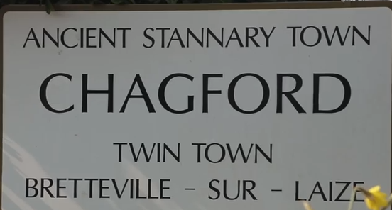
The Three Crowns Inn, opposite the church, is a picturesque building of the seventeenth century. Chagford was one of the Stannary towns, but no remains of the court-house exist.

On Mattadon, above the town, stands a rude early cross of granite.

The ascent to the moor by Tincombe Lane, as I remember it half a century ago, was no better than a watercourse, strewn with boulders, to be scrambled up or down at the risk of dislocation of the ankle. It then well merited the descriptive lines:—


"Tincombe Lane is all uphill
   Or downhill, as you take it;
 You tumble up, and crack your crown,
   Or tumble down and break it.

"Tincombe Lane is crook'd and straight,
   Here pothook, there as arrow,
 'Tis smooth to foot, 'tis full of rut,
   'Tis wide, and then, 'tis narrow.

"Tincombe Lane is just like life,
   From when you leave your mother;
 'Tis sometimes this, 'tis sometimes that,
   'Tis one thing or the other."


Now all is changed. A steam-roller goes up and down Tincombe Lane, the angles have been rounded, the precipitous portions made easy, the ruts filled up. And life likewise is now made easy for the rising generation—possibly too easy. Ruggedness had a charm of its own, and bred vigour of constitution and moral physique.

Chagford having lost, by death, the whistling clerk, started a blind organist. Now, also, he is gone. Every peculiarity is being crushed out of modern life by the steam-roller, civilisation.

Chagford Common, as I recall it, half a century ago, was strewn thick with hut circles. One ascended to it by Tincombe Lane and came into a prehistoric world, a Pompeii of a past before Rome was. It was dense with hut circles, pounds, and every sort of relic of the ancient inhabitants of the moor. But inclosures have been made, and but a very few relics of the aboriginal settlement remain. One of the most curious, the "Roundy Pound," only escaped through urgent remonstrance made to spare it. The road carried over the common annually eats up the remains of old, as the road-menders take away the stones from the hut circles to metal the highway.

At Batworthy, one of the inclosures, there must have been anciently a manufactory of flint tools and weapons. Countless spalls of flint and a fine collection of fabricated weapons and tools have been found there, and the collection has been presented from this place to the Plymouth Municipal Museum.

On Gidleigh Common, beside the Teign, opposite Batworthy, is Scaur Hill circle. It consists of thirty-two stones, at present, of which eight are prostrate. The highest of the stones is a little over six feet. The circle is ninety-two feet in diameter. Apparently leading towards this ring, on the Chagford side of the river, was a very long double row of stones, with a second double row or avenue branching from it.

There was a third double row, which started from the Longstone, near Caistor Rock. This Longstone

is still standing, but the stone rows have been


Plan of Stone Rows Near Caster Rock (Taken in 1851, Scale 1/12 in. to 10 feet.) A. The Longstone. Hence in a northerly direction the row continued for 520 feet. B. Cairn. C. Cairn with ring of stones.shamefully robbed by a farmer to build his newtake walls. I give plan of the rows as taken by me in 1851. There was another line of stones leading from the Three Boys to the Longstone. The Three Boys were three big stones that have disappeared, and the line from them has also been obliterated. This portion I unfortunately did not plan in 1851.

In the valley of the Teign is the so-called tolmen, a natural formation. In the same slab or stone may be seen the beginnings of a second hole. But it is curious as showing that the river at one time rolled at a higher elevation than at present. The scenes on a ramble up the river from Chagford to Holy Street Mill and the mill itself are familiar to many, as having furnished subjects for pictures in the Royal Academy.

The river Teign below Whiddon Park winds in and out among wooded precipitous hills to where the Exeter road descends in zigzags to Fingle Bridge, passing on its way Cranbrook Castle, a stone camp. The brook in the name is a corruption of burgh or burrh. On the opposite side of the valley, frowning across at Cranbrook, is Prestonbury Camp.

With advantage the river may be followed down for several miles to Dunsford Bridge, and the opportunity is then obtained of gathering white heath which grows on the slopes. At Shilstone in Drewsteignton is the only cromlech in the county. It is a fine monument. A few years ago it fell, but has been re-erected in its old position. After recent ploughing flints may be picked up in the field where it stands.

Gidleigh merits a visit, the road to it presenting many delicious peeps. Gidleigh possesses the ruin of a doll castle that once belonged to the Prouze family. The church contains a screen in good preservation. In the parish of Throwleigh is the interesting manor house Wanson, of which I have told a story in my Old English Home.

But perhaps more interesting than manor houses are the old farm buildings in the neighbourhood of Chagford, rapidly disappearing or being altered out of recognition to adapt them to serve as lodging-houses to receive visitors.

One such adaptation may be noticed in Tincombe Lane. An old house is passed, where the ancient mullioned windows have been heightened and the floors and ceilings raised, to the lasting injury of the house itself, considered from a picturesque point of view. A passable road leads up the South Teign to Fernworthy, a substantial farm in a singularly lone spot. But there was another farm even more lonely at Assacombe, where a lateral stream descends to the Teign, but it has been abandoned, and consists now of ruin only. Near it is a well-preserved double stone row leading from a cairn and finishing at a blocking-stone.

At Fernworthy itself is a circle of upright stones and the remains of several stone rows sorely mutilated for the construction of a newtake wall. In a tumulus near these monuments was found an urn containing ashes, with a flint knife, and another, very small, of bronze or copper, and a large polished button of horn. On Chagford Common, near Watern Hill, is a double pair of rows leading from a cairn and a small menhir, to blocking - stones. Although the stones of which they are composed are small, the rows are remarkably well preserved.

It will repay the visitor to continue his ascent of the South Teign to the Grey Wethers, two circles of stone, of which, however, many are fallen. Here exploration, such as has been conducted at Fernworthy circle, shows that the floors are deep in ashes, and this leads to the surmise that the circles were the crematories of the dead who lie in the cairns and tunnels in the neighbourhood.

Near the source of the North Teign is Teignhead House, one of the most solitary spots in England. A shepherd resides there, but it is not for many winters that a woman can endure the isolation and retain her reason.

And yet there remain the ruins of a house in a still more lonely situation. The moorman points it out as Browne's House.

Although, judging from the dilapidation and the lichened condition of the stones, one could have supposed that this edifice was of great antiquity, yet it is not so by any means. There are those still alive who remember when the chimney fell; and who had heard of both the building, the occupying, and the destruction of Browne's House. Few indeed have seen the ruin, for it is in so remote a spot that only the shepherd, the rush-cutter, and the occasional fisherman approach it.

On the Ordnance Survey, faint indications of inclosures are given on the spot, but no name is

attached. Yet every moorman, if asked what these


The River Teign, Devon


Originating on Dartmoor and entering the sea at Teignmouth, the River Teign boasts hugely diverse habitats that attract a large variety of birds and wildlife.
The Teign actually has two sources and these streams (the North and South Teign) descend the eastern slopes of the moor high above the village of Chagford.
From Chagford the River winds its way through the often wooded foothills of Dartmoor for nearly ten miles until below Dunsford it heads south, following the road to Chudleigh, Newton Abbot and ultimately into the estuary and the sea at Teignmouth.

Herons, kingfishers, dippers, grey wagtails, cormorants and goosanders can all be found along the Teign and otters are also making a comeback.

The Teign is noted for its salmon, brown trout and sea trout, with Drewe’s Weir being a good place to spot them leaping out of the water

and Tamar have not only provided Tin Streaming deposits but direct access to terrestrial deposits (and others) at Tor Royal on Dartmoor where recoveries and collections would have been brought down for final transit to the Continent.
Tin bearing Ore Load has been seen at Deckler’s Cliff plus Copper further up.


the teign gorge

According to Wace and Layamon, in the time of King Arthur (i.e. circa 6th century a.d.) Cador, Earl of Cornwall, pursued Childric the Saxon Kaiser and his troops as they fled towards their ships, which were moored (apparently) off Teignmouth Beach. Cador overtook them on the banks of the Teign.


The churls, armedwith “bats” and pitchforks, slew a large number of the Saxons and “then saw Childric that it befell to them evilly; that all his mickle folk fell to the ground; now he saw there beside a hill exceeding great; the water floweth thereunder that is named Teine; the hill is named Teinewic; thitherward fled Childric with his four and
twenty knights . . . and Cador heaved up his sword and Childric he slew . . . in the Teine water he perished.”


It seems very likely that the hill mentioned was the Ness, which was once known as Bryn Maur, or the great hill, and the battle probably took place on Shaldon sands.

The crossing from Shaldon to Teignmouth and the ferry dues were part of the perquisites of the Earl of Cornwall , who also called himself King of the Romans,
a title dating from King Arthur’s day in the 11th century a .d ., and it is probable that Cador gained these as part of the spoils of battle. By the middle of the 7th century a .d ., the valleys of the lower
Exe and the Creedy were occupied by Saxons, and the Britons as the Celtic and Mediterranean peoples called themselves lived
more or less amicably with them in the town of Exeter, but Devon
was still predominantly Celtic and was ruled by a Celtic monarch. At this time, Bishop Honorius of Canterbury settled the boundaries
of the land and fixed parishes. Taintona probably received official recognition.

The parish of St. Nicholas was designated at Bryn Maur (Celtic for “Great Hill”) now corrupted into “Ringmore.” Taintona was probably not called by that name in those days,
as “ton” or “tun” is a Saxon word for a settlement, and means a fencible place. It was, however, a fortified village.
In 682 a d , Centwine, the Angle, “drove the Britons of the west as far as the sea, at the sword point” . This seems to indicate a more determined Anglo-Saxon invasion of Devon and an attempt to push the Celts further west. Assuming the Exe to be in the hands
of the Saxons, the sea mentioned is probably the natural boundary made by the river Teign. It is probable that the Saxons took over
Taintona and gave it a name in their own tongue, while the Celts moved across the river.
The old hillside lookout above the Teign now fulfilled another purpose; that of a Celtic spyhole against the Saxons.
In 800 a .d ., Egbert made another attempt to extend the Saxon
rule in Devon, but at this time the Saxons themselves were being
harried.
Another race of marauders was sweeping down on Britain.
These were the Danes. Now began a time of fear. The Saxon
settlers complained that the sea, formerly their friend, was now putting greens and tennis courts, and with an entertainment pavilion. From the centre of The Den the Pier extends a distance of six hundred feet. It has recen tly been rem odelled, and
possesses a sheltered prom enade and a Ballroom . A t the southern end of the Promenade, know n as The Point, are the ferry to Shaldon and boats for fishing, rowing, or sailing. Near T h e P o in t is the Lighthouse, the red lamp of w hich, in connection w ith a sim ilar one on the front of Powderham Terrace, guides the mariner safely into the haven at night. O ther
features of this end of The Den are the Lifeboat House and the Coastguard Station. Here, too, is the main Parking Place for cars.
It is a fine walk northward from the other end of The Den to Hole Head, where the railw ay leaps the little cove a t the foot of Smugglers’ Lane, as charming as it is short.
Bitton Park, about five acres of well-kept and sheltered gardens a t the west end of the town, a little short of the bridge, and overlooking the river, formed part of the old
Bitton estate, once the seat of that Lord Exmouth famed in connection w ith the bombardment of Algiers.
Teignmouth consists of two parishes— East and West Teignmouth, divided by the covered-in stream , the Tame—
and each parish has its ow n church. That of East Teignmouth, St. Michael’s Church, took the place of an old Norman edifice in 1823. W hen the latter was removed, it bore
marks of ill-usage received a t the hands of the French in 1690. A screen w ith rood was erected in r923, and in 1927 the Bishop of Exeter dedicated a Lady Chapel and new vestries.
St. James’s Church, West Teignmouth, is a heavy, battlem ented octagonal building, its interior presenting a peculiar appearance on account of the slender pillars, supporting the
roof, in the centre of which is an octagonal lantern. The reredos is a beautiful specimen of fourteenth-century stone carving. The tower is all that remains of the structure mentioned in Bishop Bronescombe’s Register, dated 1275.
The bells in it are said to have been rung after the battle of Crecy , 1346; but they were recast in 1879.
From Shaldon or Teignmouth many pleasant excursions


working of tin in the form of pieces of tin slag,
tin ingots,
and small artefacts which indicate that tin was being collected from Britain’s raw materials and worked from within our shores.
Slag has been recovered on a few sites such as Dean Moor in the Avon Valley ,
Caerloggas near St. Austell
others (Tylecote 1990, 43).
Cassiterite pebbles have also been found on Bronze Age sites which suggest evidence for extractin

The upper course of the river Teign.

Earliest times to present day
Countless ages ago, the earth threw up the molten rock which was to become Dartmoor, the backbone of the County of Devon. Convulsive movements raised and lowered the land, so that the great rock mass became part of a vast continent which included the land which we now call France.
Then the sea rushed in, filling the depression which was to become the English Channel and making islands of the rocky promontories of the Continental coasts. Movements continued intermittently over thousands of years, and masses of sand, silt and pebbles were laid down around the rock mass. The ice ages came and went and, although they did not reach as far south as the embryonic Dartmoor, snow-slips which preceded the glaciers carried debris which was scattered over the Moor as “clitters.”
In warmer intervals between the centuries of ice, there were great floods of rain, which weathered and split the great rock plateau and rushed down from the high land in steep, stormy torrents - the beginning of the Taw, the Torridge, the Plym, the Dart and the Teign. The Teign carried with it thousands of tons of rotted granite, which it laid down in its lower reaches as boulder clay. It cut for itself a narrow course through the softer rocks below the Moor and eventually poured into the sea through a sunken valley which we now call the Teign Estuary.
At the mouth of the valley, the current of the river, checked by the sea and by broken rocks, silt and sand, built up an area of beachy mud. The river, deflected by this barrier, took a sharp turn to the right and cut a way for itself at the foot of the great cliff which we now call the Ness.
The heaving crust of the earth had now become more stable. Life had established itself on the land and the brown bear, the mammoth and the sabre-toothed tiger were wandering over the countryside, hunting, and being hunted by, primitive man. The caves at Brixham and Torquay show traces of man’s habitation and there are signs that wild beasts lived there too. No doubt Palaeolithic man hunted over the hills around Teignmouth and fished in the Teign, but there is no record of inhabited caves in or near Teignmouth.
Thousands of years later, Bronze Age man lived on Haldon and he regarded the shores of Teignmouth as a good place to obtain supplies of salt for preserving his meat and for adding savour to his food.
References in the works of Greek and Roman writers show that in pre-Roman times there was a flourishing civilization in the West of England, based on the trade in tin, which was used in the manufacture of bronze for weapons. This civilization had its centres near the tin-working areas on the Moor, but salt had to be brought from the coastal areas, and poor villages around the coast subsisted
one
on their trade in salt. There is a tradition of salt-pans in Teign-mouth, and a charter of Edward the Confessor mentioned “salterns” in the district.
There is a well-marked trackway across the Moor from the Belstone area, through the Teign valley to a spot on the Teign estuary now called Salcombe (a corruption of Salt-coombe), where salt was made on the banks of a fresh water rivulet. There is little doubt that, at this time, the land below Salcombe was too dangerous and too marshy for any settled habitation or industry. These early vendors of salt must have been a small dark people, probably of Mediterranean stock, who had intermarried with Phoenician and other Mediterranean traders. They had probably originally worshipped the Mother Goddess, the moon, but by the Bronze Age they had given their allegiance to a Father God in the form of the sun.
The taller, blonder Celts, moving westwards owing to pressure from the eastern invaders, intermarried with these early Devonians and their children were either small and dark, like the original inhabitants of the land, or tall and blond, like the newcomers. Both types are commonly found in Devon to this day.
The coming of the Romans did not make such an impact on Devon as it did on the rest of the country. Exeter was a Roman station of importance and the head of Roman power in the district, and there are a few evidences of Roman occupation west of Exeter. For the sake of trade, the Romans kept up the system of British trackways within the County, but they only adapted the existing roads - the salt-tracks and trade-routes across the Moor, which had been built centuries before and ran straight across hillside and valley, the way being marked by crosses and beacons.
Up to about 250 a.d., Britain was a comparatively peaceful Roman colony, but, from that date onwards, it was harried by Saxon pirates. British families moved inland away from the seaboard, and it is probable that at this time the salt-pans of Bishopsteignton and Teignmouth were more or less abandoned. The fortified mound still visible on the hillside across the river from Bishopsteignton was probably built at this time as a shelter and a defence. The long-drawn-out “Hoo-oo” from the watcher on the hill would send the people of Taintona, as the village was later known, scurrying to safety, driving their flocks and herds before them.
Between 350 and 450 a.d., the Roman Empire was breaking up. Money and men were in short supply and few defences were built against the marauding Saxons in the West. There was everywhere a gradual decline in civilized living. Devon and Cornwall, whose inhabitants were known as the West Welsh peoples, dropped every appearance of Roman civilization and reverted to Celtic customs and ways of life. The rest of England came under Saxon sway. Meanwhile, Christianity was being spread over the whole island by traders.
two
According to Wace and Layamon, in the time of King Arthur (i.e. circa 6th century a.d.) Cador, Earl of Cornwall, pursued Childric the Saxon Kaiser and his troops as they fled towards their ships, which were moored (apparently) off Teignmouth Beach. Cador overtook them on the banks of the Teign. The churls, armed with “bats” and pitchforks, slew a large number of the Saxons and “then saw Childric that it befell to them evilly; that all his mickle folk fell to the ground; now he saw there beside a hill exceeding great; the water floweth thereunder that is named Teine; the hill is named Teinewic; thitherward fled Childric with his four and twenty knights ... and Cador heaved up his sword and Childric he slew ... in the Teine water he perished.”
It seems very likely that the hill mentioned was the Ness, which was once known as Bryn Maur, or the great hill, and the battle probably took place on Shaldon sands. The crossing from Shaldon to Teignmouth and the ferry dues were part of the perquisites of the Earl of Cornwall (who also called himself King of the Romans, a title dating from King Arthur’s day) in the 11th century a.d., and it is probable that Cador gained these as part of the spoils of battle.
By the middle of the 7th century a.d., the valleys of the lower Exe and the Creedy were occupied by Saxons, and the Britons (as the Celtic and Mediterranean peoples called themselves) lived more or less amicably with them in the town of Exeter, but Devon was still predominantly Celtic and was ruled by a Celtic monarch. At this time, Bishop Honorius of Canterbury settled the boundaries of the land and fixed parishes. Taintona probably received official recognition. The parish of St. Nicholas was designated at Bryn Maur (Celtic for “Great Hill”) now corrupted into “Ringmore.”
Taintona was probably not called by that name in those days, as “ton” or “tun” is a Saxon word for a settlement, and means a fencible place. It was, however, a fortified village.
In 682 a.d., Centwine, the Angle, “drove the Britons of the west as far as the sea, at the sword point”. This seems to indicate a more determined Anglo-Saxon invasion of Devon and an attempt to push the Celts further west. Assuming the Exe to be in the hands of the Saxons, the sea mentioned is probably the natural boundary made by the river Teign. It is probable that the Saxons took over Taintona and gave it a name in their own tongue, while the Celts moved across the river.
The old hillside lookout above the Teign now fulfilled another purpose; that of a Celtic spyhole against the Saxons.
In 800 a.d., Egbert made another attempt to extend the Saxon rule in Devon, but at this time the Saxons themselves were being harried.
Another race of marauders was sweeping down on Britain. These were the Danes. Now began a time of fear. The Saxon settlers complained that the sea, formerly their friend, was now
three
their enemy, because it bore the bloodthirsty Danes. The Northmen, whether Danes or Norsemen, were collectively called Vikings, and they were very fierce. Their pagan gods demanded terrible sacrifices, and blood-lust was their dominant characteristic.
The people of Taintona, tilling their tiny fields on the well-drained hillsides, tending their salt-pans and fishing and hunting along the Teign, heard terrible stories of the havoc wrought by the Vikings in other places and feared that, sooner or later, their peaceful life would be disturbed. Travelling tradesmen brought them the news of raids along the south coast. Lookouts were told to keep a sharp watch for the dreaded longboats nosing their way among the sandbanks at the river mouth. Children were warned to come from their play at the first shout. Cattle and sheep were kept near the village stockade. In the evenings, the people gathered together to hear stories, sung in rude verse about mighty deeds of old, and about present catastrophes.
They worshipped the Christian God, but they cautiously propitiated the old pagan gods; the uncertain spirits of the trees, the streams and the standing stones. They lived a poor life, their staple diet being fish and molluscs, coarse bread and gruel. They worked from dawn till dusk and thought themselves happy. Their houses were built of mud or wood and were tiny, uncomfortable dwellings which they often shared with their animals. Down river from Taintona, the future site of Teignmouth was a swampy waste, bounded on one side by the sea and on the other by the river Teign. It was deeply indented by the estuary of a small stream called the Tame, which flowed down from Haldon and ran into the Teign on the landward side of the Point. Spring tides swept up this estuary as far as the rising ground of what is now Fore Street. A trackway from Taintona followed the line of Bitton Park Road and Fore Street as far as Brook Hill. It then turned sharply eastward to ford the Tame and reach the rocky foreshore just below East Cliff, where a fresh water stream ran into the sea. Here were salt-pans and fish-salting cellars (whose remains are still visible at certain stages of the tide) and a few fishermen’s huts. The people built a small chapel here in the Saxon style, where the fishermen could obtain God’s blessing before they set out on the hostile sea. There were also saltpans at the mouth of the Tame.
The people’s life was hard by our standards, but they knew no other. About 800 a.d., the thing they feared most seems to have happened. Camden reports:
“Tinemutha, a little village at the mouth of the river Teign whereof it also hath the name; where the Danes that were sent before to discover the situation of Britain and to sound the landing places, being first set ashore about the year of salvation 800 and having slain the Governor of the place, took it as an ominous good token of future victorie, which indeed afterward they followed with crueltie through the whole island.”
four
This statement is confirmed by Risdon, but other chroniclers believe that it refers to Tynemouth.
Be that as it may, it is certain that the fear of Danish invasions was a great factor in the life of the people of Taintona at that time. In 865 a.d., a great army of Vikings came and settled in Kent and the whole of Britain was gradually over-run. In 877/878 a.d., the Danes in the Exeter district were out-manoeuvred by Alfred and forced to make peace. They were also defeated in the same year by the “theigns of Devon”, and after that the bloodshed was not so great. The Danes then tended to settle and intermingle with our stock.
The Anglo-Saxon Chronicle contains many references to incursions into Devon by the Danes between 800 and 1,000 a.d. Pallig, a brother-in-law of King Sweyn, was a mercenary hired by King Aethelred to protect the coast, on the lines of “set a thief to catch a thief”. This manoeuvre was not very successful; in the year 1,001 a.d., Pallig turned traitor and joined his countrymen in rapine and pillage. The Anglo-Saxon Chronicle states that: “the Danes went Westwards till they came to the Defanas (Devon) and there came to meet them Pallig with the ships that he could muster . . . And they burned Teignton, and also many other good vills which we cannot name; and peace was afterward there made with them. And then they went thence to the mouth of the Exe, so that they went up in one course until they came to Penhoe; and there were Kola, the Kings High Reeve, and Eadsige, the Kings Reeve, opposed to them with the force that they could gather; and they were put in flight and many were slain, and the Danish had possession of the place of carnage.”
Teignton has been variously described as Kingsteignton and Bishopsteignton, but we favour the latter interpretation. Bishops-teignton is later referred to as a manor, and all manors were founded between 449 a.d. and 1307 a.d. They were instituted soon after the landing of Hengist and Horsa in 449, and they were abolished after the reign of Edward the First, who died in 1307. It is likely that Bishopsteignton was made a parish and a manor in the time of Bishop Honorius and was therefore well established, as Taintona , or Teignton, by the year 1001. It is unlikely that the Danes would sail up the Teign past such a prosperous-looking village and plunder Kingsteignton, which could only have been approached through marshy and difficult terrain.
At that time, Teignmouth can only have been a collection of miserable huts, which were probably burnt down anyway.
The district by now was entirely in Saxon hands, since King Athelstan had defeated the Celts, under King Huwel, on Haldon Hill in 927 a.d. The Celts then withdrew into Cornwall.

Athelstan celebrated his victory by founding a monastery now known as “ Old Walls ” at Bishopsteignton. At that time, the Celtic place names must have changed under Saxon pronunciation. Bryn Maur

By the time of the Norman invasion in 1066, Teignmouth was beginning to be established in its own right. In 1044, it is mentioned in the charter of Edward the Confessor, which still exists in the Cathedral Library at Exeter.

The body of this deed is in Latin, but the boundaries of the land conveyed are in Saxon, probably to facilitate local understanding. The Charter is attested by 51 witnesses, and runs as follows:
“All things above, below and in the deep are governed by the rule of the King of Kings whose unlimited benevolence, as soon as it has perceived a man who is obedient to him, both enriches him abundantly with immediate wealth, and after the completion of this miserable life, causes him to pass on the wings of angels to the kingdom of Heavenly joys. Who also by the will of the Eternal Father distributes the sceptres and the rights of kingdoms. He is surely the Lord of Lords, and without doubt the King of all Kings. The purpose for which this charter of gift has been commenced by us will consequently be clear from the succeeding paragraph. Therefore I, Edward by the help of the most mighty God, and not merely with his consent, possessor of the Monarchy of the whole land of England and of Britain, have granted to a certain worthy chaplain of mine called Leofric, a certain tract of land in the vill which the inhabitants of that region call Doflisc, that is to say seven manors of plough land in that place, by the tenure that it shall be governed honorably under his dominion and power all the days of his life and without any machination, and that he shall have power after the end of his days of appointing or nominating the the same to whomsoever he please. Moreover we direct that the aforesaid land shall be free of all fiscal tribute or tax, together with pastures, meadows and woods; except these three things, military service, the building of bridges and castles. These things having been settled in accordance with our duty or as was pleasing to our dignity and desire, a matter which should by no means be consigned to oblivion, we desire that this present written letter of our licence, may condemn, trample underfoot and anathematize all charter of rivals if any such be found in opposition to the said letter. Moreover if anyone, which I do not at all suppose will happen, shall attempt with audacious presumption, and by instigation of the devil contrary to our decree, to make of no effort or bring to nought this Charter of gift, first which is the more serious, may he incur the wrath of Almighty God, and of His Mother the pure and intact Mary, then may he incur my wrath and the wrath of all my officers; and may he know himself to be criminal and guilty at all hours and moments of his life, and may his lot be with Dathan and Abiram, and with the crafty Beelzebub, the Lord of flies, in the lower gulf, and may
six that which he basely and impudently acquires not acknowledge him, but that he may be expelled from our presence with every kind of shame, unless with fitting repentance and of his own accord and not under compulsion, he shall strive to make amends. This charter was executed in the year of the Incarnation of our Lord MXLIIII, indiction epact XVIII and concurrent VII, in leap year, the most pious King Edward happily governing the nation of the English.
“These are the land boundaries: First at Teignmouth, up along the estuary to crampan-steort, and so back again by the salterns along the street on the West side of St. Michael’s Church, and so North along the street to the great dyke; thence North back right on to the blind well, from the blind well North straight on to the downstone, thence back right along the old dyke North right on over the watershed combe; thence up along the row of old staples right along the ridge to the sand hollows along the street to the black penn; thence along the street to the top of the broad moor; and thence right along the street to the earth forts and so North along the street to the stone heap, and so down along the street to Doflisc ford and thence North from the ford along the market street to the head of the valley of rushes, so down along the stream to Cocc ford; and so along the estuary out on Exe; down back along Exe to Sciterlakes outfall and so up along Sciterlake to the estuary head, thence forward South on the old dyke and so right onto the red stone, from the stone South, out to sea, and so West by the sea back to Teignmouth.”
Leofric, who received this land, was later made Bishop of Devon and Cornwall, and this had much bearing on the subsequent history of the area.
Some interesting points emerge from this document. Edward must have felt that the “curse” winch he laid on anyone who stole the land would be sufficient to deter him. Therefore we know that the inhabitants of the area were God-fearing Christians and that any Celts who remained, and who might have had previous title to the land, would also fear the wrath of God if they defrauded Leofric. We also know that the salterns at Teignmouth must have been of some importance, since they were mentioned as a landmark.
The picture emerges of a simple, rustic folk engaged in tilling the soil, salt-making and fishing. Their standard of living was probably very low, but their overlord, Leofric, would be just, if not kind. The Danish invasions had now stopped and life was a peaceful round of sowing and reaping, of catching and curing fish, of collecting shellfish and of making and selling salt. At intervals, natural catastrophes would occur and a family would mourn a man lost at sea, or a hard winter would find them short of food; but on the whole their lives were contented.
With regard to the boundaries themselves, “crampan steort” meant a piece of land shaped like the fluke of an anchor, probably the sandbank thrown up at the mouth of the Tame. The salterns
seven
were undoubtedly on the banks of the Tame, since fresh water was needed in the process of making the salt. The word “street” did not mean a street as we understand the word, but merely a road, so that there is no indication of houses in the area, although there must have been some huts. The great dyke was without doubt situated where Dawlish Road now runs, and it probably emptied onto the beach below East Teignmouth Church. The “blind well” (a well whose opening is not visible) was situated on the East side of Woodway Road and a little North of New Road, immediately behind a house called “Wilbraham”.
When Lyfing, Bishop of Devon and Cornwall, died in 1046, Leofric was appointed to the See. He transferred the See from Crediton to Exeter, and he was still in office at the time of the Conquest.
eight
The Birth of the Town
The coming of the Normans made little impression on the County of Devon. Men went to fight and their wives mourned those who did not return, but the lives of these West Saxons, who were mixed in blood with the Celts and other, more primitive, peoples, were not disrupted to any great extent. Some of them were secretly pleased to see the Saxons overthrown, for many grieved for the old days. The Normans did not immediately penetrate to this part of the country, and one King in London is no worse than another.
In 1069, William the Conqueror made a grant of land to the Church of St. Peter at Exeter. This land included the manor of Holacumb (a hyde and a half of land adjoining Dawlish) and roughly corresponded to what is now the parish of East Teign-mouth. The charter was in Latin and was witnessed, among others, by the future William the Second. It is now in Exeter Cathedral Library.
Bishop Leofric apparently had given this land freely to William, who returned it to him as a gift to the Church, so that the See might derive its title direct from the Crown instead of through its Bishop, who was the original owner. The land was to be used “for the maintenance of Canons”, but Leofric himself retained the income from Dawlish.
Leofric died in 1073. It is interesting to note that the list of his lands does not mention a strip of land - now part of East Teignmouth - between Woodway Road and the River Tame. Perhaps this land was regarded as worthless because it was so often flooded. It was later named “Penny an Acre” or “Pennyacre”.
After Leofric’s death, it is probable that this gift of land was in some way set aside, since a later Market Charter for East Teignmouth states that the ancestors of Philip de Furnell enjoyed the possession of this land “in the time of King Henry the First and by the confirmation of King Henry the Second”.
Exeter, at this time, was a growing city. The Cathedral was being built, and, in wealth and importance, the city could have borne comparison with London, York and Winchester. In 1067/ 68 a.d., it had rebelled against William the Conqueror, but had finally submitted to his rule. In 1068/69 a.d., there was a rising throughout Devon and Cornwall to expel the Normans, but this also came to nothing. It is inconceivable that, in such troublous times, Teignmouth should have no strong views on the Norman Conquest, but there is no record of fighting men going from the town, nor of punishment imposed on local levies.
In 1085 a.d., when the Domesday Survey was carried out, the Church had lost East Teignmouth, but was still holding Bishops-teignton, or Taintona, as it was still called.
nine

TEIGNMOUTH
50
putting greens and tennis courts, and with an entertainment pavilion.
From the centre of The Den the Pier extends a distance of six hundred feet. It has recently been remodelled, and possesses a sheltered promenade and a Ballroom. At the southern end of the Promenade, known as The Point, are the ferry to Shaldon and boats for fishing, rowing, or sailing. Near The Point is the Lighthouse, the red lamp of which, in connection with a similar one on the front of Powderham Terrace, guides the mariner safely into the haven at night. Other features of this end of The Den are the Lifeboat House and the Coastguard Station. Here, too, is the main Parking Place for cars.
It is a fine walk northward from the other end of The Den to Hole Head, where the railway leaps the little cove at the foot of Smugglers’ Lane, as charming as it is short.
Bitton Park, about five acres of well-kept and sheltered gardens at the west end of the town, a little short of the bridge, and overlooking the river, formed part of the old Bitton estate, once the seat of that Lord Exmouth famed in connection with the bombardment of Algiers.
Teignmouth consists of two parishes—East and West Teignmouth, divided by the covered-in stream, the Tame— and each parish has its own church. That of East Teignmouth, St. Michael’s Church, took the place of an old Norman edifice in 1823. When the latter was removed, it bore marks of ill-usage received at the hands of the French in 1690. A screen with rood was erected in r923, and in 1927 the Bishop of Exeter dedicated a Lady Chapel and new vestries.
St. James’s Church, West Teignmouth, is a heavy, battle-mented octagonal building, its interior presenting a peculiar appearance on account of the slender pillars, supporting the roof, in the centre of which is an octagonal lantern. The reredos is a beautiful specimen of fourteenth-century stone carving. The tower is all that remains of the structure mentioned in Bishop Bronescombe’s Register, dated 1275. The bells in it are said to have been rung after the battle of Crecy, 1346; but they were recast in 1879.
From Shaldon or Teignmouth many pleasant excursions may be made up the river Teign. A favourite walk or drive is to—
COOMBE CELLARS—BISHOPSTEIGNTON 51
Coombe Cellars
about three miles from Shaldon, on the Torquay side of the river. Coombe Cellars can be reached by the motor-boats which make periodical visits, also by a delightful row up the river, but an eye should be kept on the tide. The inn makes a charming spot for afternoon tea, which can be enjoyed in the gardens or indoors. The late S. Baring-Gould made Coombe Cellars the scene of his novel, Kitty Alone. The old inn is only a memory, but the smarter building perpetuates the fame of its predecessor for Devon junkets and the finest of fresh cockles, salmon, and lobster teas. The village of Coombe-in-Teignhead is not far distant across the fields.
Its only claims to notice are its situation and its church, a cruciform building in the Perpendicular style, containing a screen of some interest, and some old bench-ends. In the village is an almshouse built by William Bourchier, third Earl of Bath, in 1620.
A mile south of Coombe-in-Teignhead is the diminutive church of Haccombe , while the Torquay road may be regained by way of Stoke-in-Teignhead
On the Teignmouth side of the river is—
Bishopsteignton
a walk or bus ride of a little over two miles from Teignmouth, or four from Newton Abbot. The village is ofl the hillside opposite Coombe Cellars and under the height of Haldon (800 ft.).
Bishopsteignton owes its "teignton” (which it shares with Kingsteignton, some three miles to the west) to its position on the banks of the river; while the prefix distinguishing it from the other village is believed to have been bestowed because Bishop Grandisson, of Exeter, lord of the manor from 1327 to 1369, erected a palace here, the walls of the chapel attached to which are still in existence—in the lane leading from the main part of the village to the Teignmouth-Exeter high road on Haldon.
The Church is dedicated to St. John the Baptist. Oliver says: “the chancel

Grimspound, and Entrance

ruins are, will tell you that it is the wreck of Browne's House.

The story told me relative to this solitary spot was that Browne, an ungainly, morose man, had a pretty young wife, of whom he was jealous. He built this place in which to live with her away from the society of men, and the danger such proximity might bring to his connubial happiness.

Grimspound will be visited from Chagford. The way to it after leaving the high-road from Post Bridge to Moreton, which it crosses, traverses Shapleigh Common, where are numerous inclosures in connection with hut circles. One of these is very large, and constructed of huge slabs of granite. Several of these larger circles were occupied only in summer, it would appear, as there are scanty traces of fire in them, whereas attached to them are small huts, the floors of which are thickly strewn with charcoal and fragments of pottery, and presumably the cooking was done in these latter.

Grimspound is an irregular circular inclosure containing four acres within the boundary wall. It is situated on the slope of a hill, and the position is obviously ill-adapted for defence, as it is commanded by higher ground on three sides. A little stream, the Grimslake, flows through the inclosure.

The wall itself is double-faced, and the two faces have fallen inwards. This shows that the core could not have been of turf, as in that case shrubs would have rooted themselves therein and have thrust the walls outward. In several places openings appear from the inside of the pound into the space betweenthe walls. It is possible that this intermediate hollow was used for stores, and that the walls were tied together with timber, and surmounted with a parapet of turf. A trackway from Manaton to Headland Warren runs through the pound, and the wall has been broken through for this purpose in two places; but the original entrance to the S.S.E. is perfect, and is paved, and in it three steps have been formed, as the descent was into the pound, another token that the inclosure was not intended as a fortress.

The entrance is 8 feet wide, and no outwork was constructed to protect it from being "rushed" by an enemy. The walls of the inclosure here and throughout are from 10 feet to 12 feet thick, and stone does not exist in any part which could raise them above 5 feet 6 inches in height. Each wall is 3 feet 6 inches wide at base, and was 3 feet at top. On the west side is a huge slab set on edge, measuring 10 feet by 5 feet, and it is from 9 inches to 1 foot in thickness, and weighs from 3 to 4 tons. Other stones, laid in courses, if not so long, are not of less weight. Such a wall as that inclosing Grimspound would cost, with modern appliances and with horse power for drawing the stone, three guineas per land yard, and a land yard would engage four men for a week.

When, moreover, we consider that the circumference of the wall measures over 1,500 feet, it becomes obvious that a large body of men must have been engaged in the erection.

Presumably Grimspound was not a fortified village,


Grimspound

and was merely a pound into which cattle were driven for protection against wolves. It is just

possible, but hardly probable, that it was the place of refuge for the scattered population on Hookner and Hamildon.

Within the pound are twenty-four hut circles; most have been explored, and one (No. III. on the plan) has been partially restored, and is inclosed within a railing. The object of this restoration was to discover, by piling up the stones found in and about the wall of the hut, what its height had been originally, and this was determined to have been four feet.

Unless wantonly injured by trippers, it will serve to exhibit what the structure of these habitations was, with its paved platform as bed, and its hearth and vestibule.

A double hut (XVIII., XIX.) is interesting because a tall stone was erected beside it, as though to indicate it as being the residence of some man of importance, maybe the sheik of the community. In hut XVI. is a double bed, one couch divided from the other by upright stones.

In several of the huts, in the floor, are laid flat stones with a smooth surface, and it was supposed that these served as chopping-stones, but further explorations have led to the belief that they were employed to sustain a central pole that upheld the roof.

On thecolabove Grimspound, near the source of Grimslake, is a cairn that contains a small kistvaen, and is surrounded by a circle of stones set upright.


Plan of Hut III., Grimspound

Numerous cairns crown the heights. One immense tumulus, King's Barrow, has at some unknown time

been excavated with great labour.

The great central trackway crosses Hamildon, and is very perfect where it does so. It had apparently no connection whatever with Grimspound.

From Grimspound may be seen, on the brow of the ridge connecting Birch Tor and Challacombe Down, a series of stone rows. They lead to a blocking-stone, or menhir, at the south extremity. The northern end has been destroyed by tin- streamers, whose works in Chaw Gully are interesting, for mining has been combined with streaming. The rock has been cut through, but no signs of the use of iron wedges for splitting the granite can here be discovered. It is traditionally told that what was done was to cut a groove in the granite, fill that with quicklime, and pour water on it. The lime in swelling split the rock. Ravens nest here; and I have seen rock doves and the pair of ravens nesting almost side by side.

Below is the Webburn, the stream turned up by tinners. There one mine continues in activity—the "Golden Dagger." Above is Vitifer, where fortunes have been made—and lost; mostly the latter by investors, mainly the former by the "captains" and promoters.

THE LEGEND OF GOOD WOMEN.  Text A (.Earlier Version).


The prologe of goode Wimmen . A thousand sythes have I herd men telle , That ther is joye in heven , and peyne in helle ; And I acorde wel that hit be so ; But natheles, this wot I wel also ,That ther nis noon that dwelleth in this contre , That either hath in helle or heven y-be , Ne may of hit non other weyes witen , But as ho hath herd seyd, or founde hit writen; For by assay ther may no man hit preve. But goddes forbode, but men shulde leve
Wel more thing then men han seen with ye Men shal nat wenen every-thing a lye For that he seigh it nat of yore ago. God wot, a thing is never the lesse so ,Thogh every wight ne may hit nat y-see.
Bernard the monk ne saugh nat al, parde! Than mote we to bokes that we finde, Through which that olde thinges been in minde, And to the doctrine of these olde wyse, Yeven credence, in every skilful wyse, 20 And trowen on these olde aproved stories Of holiness , of regnes , of victories , Of love , of hate , of other sundry thinges , Of whibhe I may not maken rehersinges . And if that olde bokes were a-weye ,
25
Y-loren were of remembraunce the keye. Wel oghte us than on olde bokes leve,
Text B {Later Version).
The prologe of .ix. goode Wimmen. A thousand tymes have I herd men telle, That ther is joye in heven, and peyne in helle; And I acorde wel that hit is so ; But natheles, yit wot I wel also, That ther nis noon dwelling in this
contree,
5
That either hath in heven or helle y-be , Ne may of hit non other weyes witen, But as he hath herd seyd, or founde hit writen ; For by assay ther may no man hit preve. But god forbede but men shulde leve 10Wel more thing then men han seen with ye! Men shal nat wenen every-thing a lyg But-if him-self hit seeth, or elles dooth ; For, god wot, thing is never the lasse sooth, Thogh every wight ne may hit nat y-see. Bernard the monk ne saugh nat al, parde! Than mote we to bokes that we finde , Through which that olde thinges been in minde , And to the doctrine of these olde wyse , Yeve credence, in every skilful wyse, 20 That tellen of these olde appreved stories,
Of holinesse, of regnes, of victories,Of love, of hate, of other sundry thinges , Of whiche I may not maken rehersinges.
And if that olde bokes were a-weye,
25
Y-loren were of remembraunce the keye.
I Wel oghte us than lionouren and beleve

SiteLock