Lostwithiel the Old Cornish Lost Gwydhyel meaning "tail-
The view from Restormel Castle looking towards the town shows how this may have come to be.
Lostwithiel is a historic borough.The Lostwithiel constituency elected two members to the Unreformed House of Commons, but was disenfranchised by the Reform Act 1832. It remained a municipal borough until the 1960s, when it became a civil parish.
The seal of the borough of Lostwithiel was a shield charged with a castle rising from water between two thistles, in the water two fish, with the legend
"Sigillum burgi de Lostwithyel et Penknight in Cornubia"
Its mayoral regalia includes a silver oar, signifying its former jurisdiction over the River Fowey.


Castle Dore lies on the ridgeway crossing the Cornish peninsula from the Camel to Fowey.
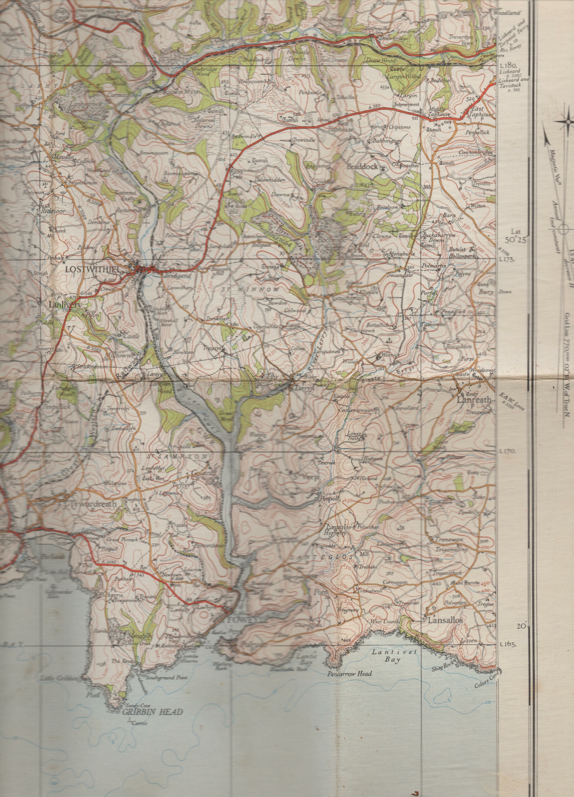
About six miles north of Fowey not far off the road to Lostwithiel is Castle Dore. difficulty finding this Iron Age hill fort
'I’here is nothing dramatic about Castle Dore:
its grandeur has lung since settled back into sleep under the ever-
All that remains is a huge rough circle of banks and ditches — a place where sheep graze or take shelter from the wind.
what is exciting about Castle Dore is that when it was excavated in the 1930s it was discovered that the fort had been reoccupied in the Dark Ages, the time of King Arthur. Was this then the legendary Palace of King Mark?
Many post holes of this period were uncovered, and there is thought to have been a great hall, ninety feet long, aisled and imposing. All round the site were dwellings, stables and storerooms of Celtic chieftains who ruled there Other than the post holes the archaeologists found no more than a few handfuls of beads of that period. Time had eroded all other evidence of those who had once lived there in the time of Arfhur.
There is a sense of peace and romance about Castle Dore which makes it. easy to accept the legend of the tragic lovers, Tristram and Iscull, who, it is believed, once lived there. Castle Dore, the old story tells us, was the home of King Mark of Cornwall, the uncle of Tristram and the husband of Iseult.
It was to Castle Dore that Tristram escorted from Ireland the young and beautiful Iseult to be his uncle’s bride. But on the journey Tristram and Iseult drank the love potion intended for her and King Mark on their wedding night. In so doing they were bound In everlasting love.
They kept their love a secret from the King until an enemy of Tristram within the court betrayed him.
Tristram fled and took refuge from Mark’s anger by hiding in the dense forest
About six miles north of Fowey not far off the road to Lostwithiel is Castle Dore.
River Fowey
River Fowey at Golant
The course of the River Fowey and neighbouring rivers in Cornwall
Basin features
Main source Bodmin Moor
298 m (978 ft)
River mouth Fowey estuary
50°19′40″N 4°38′30″WCoordinates: 50°19′40″N 4°38′30″W
The River Fowey is a river in Cornwall, England, United Kingdom.
It rises at Fowey Well (originally Cornish: Fenten Fowi, meaning spring of the river Fowey) about 1-
The upper reaches of the Fowey are mainly moorland giving way to woodland and farmland, predominantly livestock. This means that 63.6% of the catchment is grassland, with a further 18.3% woodland and 10.7% arable land. Of the remaining 7.5%, 2.6% is urban or built-
The catchment area of the River Fowey covers a total of 41,800 acres (65.3 sq. miles)[3] consisting of kaolinised granite on Bodmin Moor, Devonian slates and grits, and valley gravels.[3] Data collected by the National Water Archive shows that average flow at the Restormel monitoring station is 4.78 cubic m/s and is affected by the reservoirs at Colliford and Sibleyback and by abstraction of water for public supply.[3]
The former quarry of the Glynn Valley China Clay Works has closed down and is now flooded. It was in operation from the 1940s but since 2015 the site has been used for camping.[4]
Golitha Falls
Entrance to Golitha Woods
River Fowey at Trago Mills
12th-
The river runs through two Sites of Special Scientific Interest (SSSI), one of which is also part of a National Nature Reserve (NNR). The Upper Fowey SSSI is a floodplain on the southern slopes of Bodmin Moor and is designated for its wet heath vegetation and herbaceous valley-
The Fowey valley is designated as an Area of Outstanding Natural Beauty so many hikers, holidaymakers and tourists visit the places of interest and eat freshly caught fish. The river has very pleasant sites and special paths made for hiking and walking along the banks and in the countryside surrounding the towns.
The River Fowey is famous for its sailing because of its natural harbour. In the past it has been visited by up to 7,000 yachts in one season. Almost all sections of the river have been paddled by kayakers and canoeists: the whitewater sections high up on the moor, all the way down to the estuary. Fowey has an excellent local chandlery.
Many fish can be caught in the River Fowey so many fishermen come to enjoy the excellent fishing conditions.