
asking to be added to our national treasures.
UPHILL Hubba s Creek: cf. Pylle, Pille= creek . The K noll close by explains the popular
corruption).—The only thing “uphill” is the remains
of the originally Norman church on the end of the
knoll. There is a ferry 6d. across the Axe to Brean Down. The chief interest of Uphill is purely antiquarian. It is fairly certain that under the name of
Axium this was the harbour from which much of the produce of the Roman lead mines on Mendip was exported. The land route was by the road which has
been traced for fifty-
between Bleadon Hill, practically Mendip end, and the sea flats. Just beyond Bleadon village a bridge
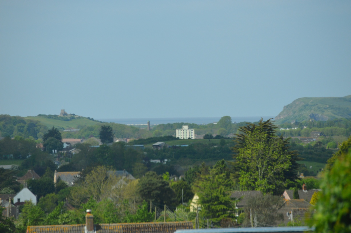
crosses the Axe, and a minute later on the left Crook’s Peak opens up, as it looks across to the group of pines that marks out Bleadon Down.
BANWELL ).—About five miles E. of Weston is Banwell; but the most effective way to see this picturesque village leaning up against Ms island hillock is to approach it from the N. across
the flats, when there comes into view a noble lofty church and an old turreted building to the E. of it.
Banwell is quite rich in interest: it has, besides the church and old manor-
three miles S. of Congresbury is Churchill, under the prehistoric camp of Dolebury.
There is another Camp at Dinghurst , West of the Bristol road, and two miles west of that yet another at Banwell. Nearly every convenient promontory hill hereabouts seems to have been fortified before the Romans came. The village is very pleasing. In the church, the north aisle has a good roof and there are carved bench-
It is said that these were the ancestors of the Sarah Jennings who became Duchess of Marlborough, and that the Duke was descended from the Churchills of the old mansion of Churchill.
But I cannot vouch for this story. Dolebury Camp is to the E. of the curve in the Bristol road before it forks to Shipham and Sidcot. It is a very remarkable work on the summit of the hill, some 20 acres in extent, the defences consisting on the N. side of two fosses and two valla, “a double line of gigantic stone embankment”, says Mr Hadrian Allcroft, “some 550 yards in length, representing a truly enormous amount of labour. On the southern side the hill is so steep that one vallum only was deemed sufficient protection”.
At the Eastern end, the weakest part, the two valla reappear and reach “an amazing size”. The entrances are W. and N.E. Inside, the camp area is divided by four parallel banks, but these are quite possibly comparatively recent work.
Generations of miners have dug here for minerals. Leland quotes an old rhyme:
“If Doleberie dygged were,
Of golde shuld be the share”.
8o WESTERN MENDIPS Winscombe is one of many isolated manors belonging to the Abbey of Glastonbury, accessible by the road along the length of the Wedmore ridge. It is a very pleasant place, with its church set on rising ground and commanding a fine view. The tower, of the triple-
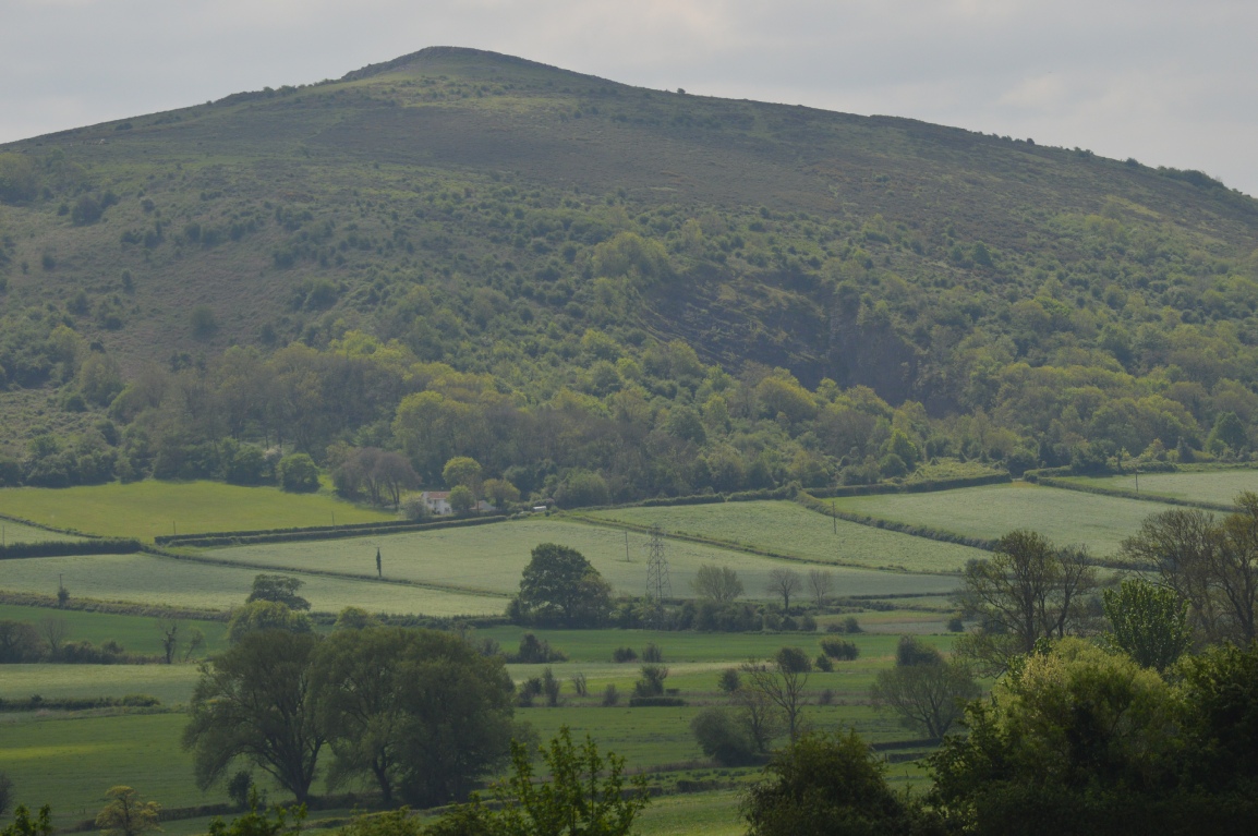
Mendip. Ascend the 630 feet of Crook’s Peak, from
which there is nothing N., S., and W. to bar the view
for many miles.
BLEADON HILL 975 and D ., Bledone: either a
purple hill or Bledda’s hill.— The villages of Bleadon
are Loxton and Christon on the E. side, Hutton N.W ., and Bleadon S.W. They are all on Rhxtic beds of Keuper marl, like Winscombe and Shipham, not on
carboniferous limestone like the generality of the Mendip country. Loxton’s amenity is that it looks up at Crook’s Peak. The church, slightly away from
the road E., has a short tower on the S. side, a
curious squint in the porch, a fine pulpit (Pcrp.) of
carved stone,' and a good screen. Christon’s small
church, with central tower, though aisleless and trail
septless, deserves a visit for its Norman work. Under
the tower note two Norman lurches with double
chevrons and other mouldings, and the lozenge
moulding of the S. door arch. Bleadon is below the
penultimate hill camp, now not easy to trace. Its
church, not so interesting as that of Loxton, has a
Slayer = llofrudd
'Murderer's spring/stream'.the agent which causes death , asiant sy'n achosi marwolaeth
Murderers were often drowned in streams, but it has been suggested that in this case that spring or stream in questioned was considered poisoned or contaminated.
Elements and their meanings
bana (Old English) A slayer; the agent which causes death.
wella (Anglian) A spring, a stream
.aloud for a complete investigation and thorough planning.
UPHILL (D., Opopille—? Hubba s Creek: cf. Pylle, Pille=creek. The Knoll close by explains the popular corruption).—The only thing “uphill” is the remains of the originally Norman church on the end of the knoll. There is a ferry (6d.) across the Axe to Brean Down. The chief interest of Uphill is purely antiquarian. It is fairly certain that under the name of Axium this was the harbour from which much of the produce of the Roman lead mines on Mendip was exported. The land route was by the road which has been traced for fifty-
It is a pretty piece of road between Bleadon Hill, practically Mendip end, and the sea flats.
Just beyond Bleadon village a bridge crosses the Axe, and a minute later on the left Crook’s Peak opens up, as it looks across to the group of pines that marks out Bleadon Down.
BANWELL — About five miles E. of Weston is Banwell;
but the most effective way to see this picturesque village leaning up against Ms island hillock is to approach it from the N. across the flats, when there comes into view a noble lofty church and an old turreted building to the E. of it. Ilanwell is quite rich in interest: it has, besides the < liurch and old manor-
in son monastery given by Alfred to Asser, like I ongrcsbury.