Location

Statutory Address:Bury Barton Farmhouse, Lapford

The building or site itself may lie within the boundary of more than one authority.

County:Devon

District:Mid Devon (District Authority)

Parish:Lapford

National Grid Reference:SS 73288 07116

Details

This list entry was subject to a Minor Amendment on 15 June 20203 to remove superfluous source details from text and to reformat the text to current standards SS 70 NW 4/56

LAPFORD Bury Barton Farmhouse

26.8.65

GV II* Large farmhouse. Probably late C14-early C15 with C16 and C17 improvements.Mostly plastered mudstone rubble but including some cob, and some exposed stone rubble to rear; rubble stacks topped with C19 and C20 brick; slate roofs (originally thatch).

Essentially an L-shaped building with attached service wings. Main block faces the inner court of farmbuildings (qv) to the north. It is made up of the former medieval hall, now main living room and a store, at the right (west) end, through passage and service end (now dining room), with smaller and narrower dairy block on same axis projecting from left (east) end. The rear or east wing projects at right angles behind the service/dining room and contains a stair lobby and rear kitchen. A single room secondary service annexe is attached to east side of kitchen. Hall has front projecting lateral stack; service dining room and kitchen have end stacks, latter with large oven projection. C19 west end stack to main block serves first floor only. Main stair now in through passage. Now two storeys throughout. North front has irregular two window front of C19 casements with glazing bars including some original glass. Passage doorway is almost central and contains a C19 six-panel door and gabled and tiled roofed porch. To right are the two ground floor windows, one each to dining room and dairy. First floor windows over porch and to dining room chamber. At first floor level the dairy is recessed very slightly from main front but the recess fades out at ground floor level. To left of the passage door is the large hall stack and left end is blind but includes a wide C16 or early C17 timber hoodmould for a now blocked ground floor window. Roof is gable-ended.

Rear two window front to rear of main block. C19 part-glazed six-panel door with flat hood on shaped timber brackets to rear of passage at right end. C19 plank door to store at left end. C19 casements with glazing bars to hall and first floor right. C19 sixteen-pane sash to first floor, one with horns, C19 casement with glazing bars to kitchen and late C19 French windows to stair lobby. Roof is gable ended.

Good interior including the core of a medieval house and many features from C16 and C17. House has a long and complex structural history. The medieval fabric can only be seen in the roofspace. Much of the late C14-early C15 roof survives. Hall has a three bay roof up to present west end where the remains of a spere truss remain embedded in the wall. The roof appears once to have continued westwards. The medieval upper end has been demolished apparently. At lower (east) end of passage is an intact spere truss and some of the roof continues eastwards over the service end and includes evidence for a return into rear wing where an identical roof structure also survives; a single truss towards the front with purlins ridge and common rafters continuing north and south. Over the stair lobby/kitchen crosswall the roof stops and the ridge suggests that there was once a closed truss at this point. The structural timbers are of large scantling throughout. The spere truss comprises vertical aisle posts supporting the square set purlins and bridged by a flat collar. Beneath the collar one long curving brace survives of the original two which formed an arch with daub filled spandrels. On top of the collar a king post, braced each side by diagonal braces from the collar, supports the ridge. On the hall side a curving arch brace rises from the king post to the ridge. There are also horizontal diagonal braces from the collar to the purlin. The three trusses are identical. They are jointed crucks with unusual scarfed joints and face-pegged with a slip tenon (c.f. nearby Rudge Farm, Morchard Bishop). In the front wall of hall the foot of a truss can be seen resting on a large template approximately 1.5 metres above floor level. The principals have a cambered collar with slightly-hollow chamfered archbraces below. At the apex a large yoke holds the principals which clasp the ridge (Alcock's Type H). They carry the butt purlins and single sets of windbraces. The hall roof and the fragment surviving over service end is heavily sooted indicating that the original house was open to the roof and heated by an open hearth fire. The roof in the wing is only slightly smoke-blackened if at all and may have been floored. The common rafter couples are collared throughout. The dairy wing also includes a similar scarfed jointed cruck truss with same type H apex but no arch or windbraces; a straight collar and carries diagonally-set threaded purlins. Thus this small block must be as early or not much later than the main build.

In C16 and C17 fireplaces were added and floors inserted as the house was adapted to its present layout. Hall stack is probably C16 but fireplace is blocked. Hall floored probably in early C16-early C17 and one of two crossbeams is exposed; it is moulded towards the upper end with bar-chamfer stops and chamfered towards the lower end. Lower end has tall late C16-early C17 oak plank-and-muntin screen; its muntins are chamfered with runout stops and it includes a central flat-arched doorway. On the chimney breast is a moulded plaster overmantel featuring an heraldic achievement in a strapwork cartouche and featuring flowers and putti. The heraldry and flanking initials are thought to commemorate the marriage of John Bury and Mary Arscott of Tetcott in 1614. The service end dining room was renovated in C19 and ceiling beams are hidden. It includes a large granite and volcanic stone fireplace with plain soffit-chamfered oak lintel and includes a blocked side oven to right. It is probably C17. Rear wing shows mostly C17 features. Kitchen and stair lobby are divided by an oak plank-and-muntin screen; chamfered muntins with scroll stops. Two kitchen crossbeams are chamfered with straight cut stops and fireplace is blocked but; is known to have a flat-arched lintel. Roofs over kitchen and ancillary service wing are C17 with A-frame trusses with pegged lap-jointed collars with shaped halvings, and there is a similar truss with dovetail halved collar in the dairy wing. Some of the first floor rooms have C17 moulded plaster cornices, often exposed only in roofspace, which indicate that most of internal crosswalls are C17 or earlier.

This house is important principally because of its well-preserved medieval roof. The first certain documentary reference to Bury Barton is in 1502 when farm was owned by Bury family.

Listing NGR: SS7328907118

Legacy

The contents of this record have been generated from a legacy data system.

Legacy System number:96507

Legacy System:LBS

Sources

Books and journals
Alcock, NW, 'A Devon farm: Bury Barton, Lapford' in Transactions of the Devonshire Association, , Vol. XCVIII, (1966), 105-131

Legal

This building is listed under the Planning (Listed Buildings and Conservation Areas) Act 1990 as amended for its special architectural or historic interest.

 One of the intriguing aspects of Britains history is the potential Roman origins of Bartons, a key location for trade through waterways. The geographical significance of Bartons suggests its vital role in facilitating commerce during ancient times. Exploring the remnants of this historical trading hub allows historians to delve deeper into Devon's past and understand its cultural and economic importance.

The origins of Barton and its association with Roman trade routes continue to inspire historical research and speculation. The abundant waterways in the region provided an ideal environment for commerce and played a vital role in connecting different areas. Historians can uncover the remnants of this ancient trading network in Bartons, gaining valuable insights into the economic activities and cultural exchange that took place in Devon centuries ago. By examining the geographical features and historical artifacts, historians can piece together the story of Bartons' significant contribution to Devon's past and the broader context of Roman trade in the region.

barton
Collins English Dictionary. Copyright © HarperCollins PublishersWord origin Old English beretūn, from bere barley + tūn stockade; see town but I have my own ideas, firstly and probably incorrectly that the ton on the end is saxon, is it , then what is the bar and why is it , so common ,that these Bartons relate , at least lets say they are old fashioned in terms of E culture 2021 ,some mention of priories under invesgation of roman port @ merthen


north taw barton devon


Romans crossed the River Taw at what is now Newland Mill, a little outside the present town, and established a succession of military camps there over the years.

The Roman fort is believed to have had the name Nemetostatio, meaning "The road-station of the sacred groves", and may have been located on the site of an ancient druidic sanctuary.

It covered an area of roughly 600 ft (185m) east-west by 390 ft (120m), and was located adjoining the Roman road between Isca Dumnoniorum ,(Exeter), and Okehampton. In addition, the site of a temporary marching camp has been identified half a mile to the north.

North Tawton station in 1970.
By the time of the Domesday survey (1086), there were six farm / manor holdings in what is now North Tawton Parish, including that of Tawton which was the forerunner of the town we know today.
St Peter's Church is first recorded in 1257.

Only the tower of the present building dates from that time, with the rest being mostly 14th and 15th century.


The tower is on the west and is topped by an oak-shingled spire.

There are two aisles with granite arcades and a number of old benchends.

North Tawton station in 1969
North Tawton was already a market town by the end of the 12th century.

Agriculture and the woollen industry provided the chief sources of employment for many centuries, but the former has much declined as a source of employment and the latter has gone altogether, the last town woollen mill closing in 1930.
The railway came to North Tawton in 1865.

North Tawton railway station (now closed) lies a mile or two outside the town on the line from Exeter to Okehampton which continued on to Plymouth and Cornwall. It closed to through passenger traffic in 1968, although a shuttle service between Okehampton and Exeter continued until 1972.
Bathe Pool, a grassy hollow near North Tawton, is said to fill with water at times of national crisis.

Some account of the Scots and Britons about the year 80 a.d. Red hair in the North of Britain and dark men in the West. The Britons are more easily beaten by the Romans because they do not often combine to fight a common foe. What they grow, and how they fight. Qui Caledoniam habitant rutilas habent comas et magnos artus. Silurum colorati uultus et torti plerumque crines. Rams duabus tribusue ciuitatibus ad propulsandum commune periculum conuentus : ita dum singuli pugnant uniuersi uincuntur. Solum fecundum est praeter oleam uitemque et cetera calidioribus terris oriri sueta. In pedite robur est; quaedam natlones et curru proeliantur : honestior est auriga ; clientes propugnant.

NOTES ON ROBOROUGH (NORTH DEVON)
ITS MANORS AND BARTONS
MAY F. C. (MRS. BRUCE) OLIVER
“ Where are the high born dames, and where their gay attire and jewelled hair , and odours sweet , Where are the gentle knights that came to kneel and breathe love’s ardent flame
Low at their feet , Tourney and joust that charmed the eye,
And scarf and armoured panoply
And nodding plume,
What were they but a pageant scene P”1
The isolated little village of Roborough is in these days a place of very quiet charm. The cottages are mostly thatched, but some still show the ancient wide chimney and here and there the old-time oven can be seen bulging and round in the walls ; the water is drawn from wells, and in the evening the soft glow of lamplight is the only lighting. In past ages the church and group of cottages was the heart of large manors and bartons occupied by families of ancient name and sufficient wealth.
In prehistoric times a camp of Early Iron Age flourished.

Roborough in Ten Oaks Woodis ascheduled monumentlocated inDevon, England. This ancient hillfort, nestled within the wood, provides valuable insights into theIron Age settlement and exploitationof the area. The site features a well-preservedrampart and ditch, with an outer agger. Additionally, an outwork encircles two-thirds of its extent on the northwest face.The main entrance likely passed through this outwork12. The hillfort spans approximately300 pacesand remains a testament to our historical heritage.

For more details, you can explore the official listing on theNational Heritage List for England1.If you’re interested in viewing photographs and drawings from the past, theHistoric England Archivecontains over a million images spanning from the 1850s to the present day1.

!Hillfort in Ten Oaks Wood

Certainly!Roborough in Ten Oaks Woodis afascinating ancient hillfortlocated inDevon, England. This historical site provides valuable insights into theIron Age settlement and human activityin the area.

Here are some key details about Roborough:

  • Location: The hillfort is nestled within the serene Ten Oaks Wood in Devon.
  • Structure: It features a well-preservedrampart and ditch, along with an outer agger. Additionally, an outwork encircles approximately two-thirds of its extent on the northwest face.
  • Size: The hillfort spans approximately300 paces, making it a significant archaeological site.
  • Historical Significance: Roborough offers a glimpse into the lives of our ancestors during the Iron Age. It served as adefensive stronghold, likely protecting the local community and their resources.
  • Exploration: Archaeologists and historians continue to study this site, unearthing artifacts and unraveling its mysteries.

!Hillfort in Ten Oaks Wood

For more detailed information, you can explore the official listing on theNational Heritage List for England[1]. Additionally, theHistoric England Archivecontains a wealth of photographs and drawings spanning from the 1850s to the present day, providing a visual journey through time[1].

Roborough stands as a testament to our rich historical heritage, connecting us to the past and inspiring curiosity about the lives of those who once inhabited this ancient hillfort.


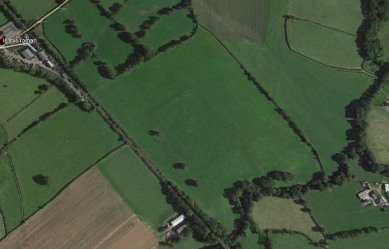
It is situated about three miles from Roborough in Ten Oaks wood, separated from the present village by a very deep and well-wooded valley. The camp is surrounded on three sides by a stream. It is defended by a rampart and ditch,
with an outside agger still very perfect; an outer work embraces two-thirds of the camp. These iron age men belonged to the drift of later Celts, which flowed west about five
hundred B.C.2 They were not unlike the Bronze Age man they followed, and it was this earlier race who spoke an Aryan tongue, and left the impress of their language on Scottish,
Gaelic and Manx.3 It would appear that the track of early man crossed through the present village of Roborough in a fairly straight line, and then down to the valley of the Taw.
From the Domesday Survey we learn that in the time of the reign of Edward the Confessor the manor of Ruaberga was held by the Saxon Ulveva. It paid geld for if hides and
could be ploughed by fourteen ploughs.

NOTES ON ROBOROUGH (NORTH DEVON),
240
It was then given to the Bishop of Coutance. The Survey continues: “ Now Drogo holds it of the Bishop. Thereof Drogo has i | virgates in demesne and one plough ; and the
villeins have one hide and virgate and eight ploughs. Drogo
has there 15 villeins, three bordars, five serfs, 15 beasts, 9
swine, 60 sheep, 20 acres of wood (land), 16 acres of meadow,
and 20 acres of pasture. Worth £3 a year ; when the bishop
received it, it was worth £4.“
The dominant factor in agriculture was the plough, which
in its most powerful and effective form needed a team of
eight bullocks to draw it. Usually the team was made up by
villeins each contributing oxen, and forming a plough group.
The furrow was the length which could be made in one drive
without stopping ; it was about 40 rods, and became the
furrow length or furlong. Each furrow was so close to the
preceding one that the sod turned over and filled the hollow'
left by the plough. When the lengths attained the breadth
of one rod, it was called a rood. Four roods appear to have
been the average day's turn out of work by a fully equipped
team, and became in A.S. an acre. It was reckoned that the
plough could work about one hundred and twenty acres in a
year. This measure has generally been accepted as a hide.
The levy on the manor per hide was unpopular, and under
the Saxon regime seems to have been resorted to for Danegeld
only. The Normans by the aid of the Domesday register
tried to make it a source of revenue, but the collection gave
so much trouble that attempts ceased after 1163.
In 1166 Erkenbald of Flanders held in Roborough 1 fee
with William de Ruaberga as tenant. It was held of the
honour of Barnstaple through Baldwin Flemming. In 1241
the fee was held by Alexander de Cloigny. Writing of
Roborough Sir William Pole states that Alexander was lord
there in 1243, and that seventy years later a William de
Cloigny was lord in 1315.
Historians tell us that the year 1315 was a year of famine
and high prices. Indeed, food was so scarce that dogs and
even carrion and loathsome animals were eaten and barons
were in some instances unable to support their retainers and
had to turn them away to roam about the country robbing
and poaching in quest of food.4 In the year 1316, the name
of Baldwin Flemming is given in the Feudal Aids as the lord
of Roborough, with no tenant as there had been in previous
years, and one might speculate if the very uneasy times would
have led to this vacant manor.
Thirty years later in 1346 in the reign of Edward III the
manor was held by Walter Pollard and Henry Barry for
one fee, “ which William de Cloyngni aforetinme held, and

ITS MANORS AND BARTONS
24I
was charged for his relief/’5 These two families continued to
hold the manor, for in 1428 Walter Pollard (probably the son
of the above-mentioned Walter Pollard) Thomas Smyth,
Richard Barry, William Wyke, and Elizabeth at Combe were
the freeholders.
The home of Elizabeth at Combe was a small estate which
Prince tells was so “ called for lying in a combe or valley ;
which combe lyeth in Rowburrow.” 6 Domesday Survey has
it registered as a small estate of 1/20 to r/40 of a fee. It was
held in 1241 by two owners, W. Cusin and Elyas de Combe,
who held it of a middle lord in the honour of Barnstaple ;
and in 1303 Thomas de Wanseley (of Wansley Barton) and
Walter de Frenseton held in the same township. In 1309
Henry de la Combe, most probably the son of Elyas, and
Emma his wife, settled half the fee upon themselves for life
with the remainder to Henry Durant (of Whitteslegh St.
Giles) and to his heirs.
It has been already noted that in 1428 Henry Barry and
Walter Pollard were lords of Roborough manor ; Barry’s
younger son dwelt at Combe and giving up his name of Barry
was called after the name of his house. The Barry family
were a younger branch Of an ancient Irish race the Barrys of
Barrymore. In an old Latin deed executed in the time of
Edward III, William Barry was described as “ Hiberniensis.”
This deed was transcribed by “ Marland.”
Elizabeth, the freeholder of Roborough, was the daughter
and heiress of Barry, or at Combe. She married Thomas
Wollocombe of Over Wollocombe, in the parish of Morthoe.
The arms he bore were : Argent three bars gules, a file of three
sable. The family appear to have arranged advantageous
marriages for their sons, although^ the name of the wife of
William, son of Elizabeth and Thomas Wollcombe, is given
simply as Thomasin, his son married a Cornish bride, Anne,
daughter and heiress of J. Michelstone of Lanteglas, Cornwall,
and their son married Thomsin Coles of North Tawton. From
this time the names of the brides are well known locally.
Alexander, the next in succession, married Anne, daughter
of Anthony Pollard of Horwood. The Pollards were an
influential family and carried <arms : Argent a chevron sable
between three escallops gules. Their son John married into
the Bassett family. He married Mary, the daughter of Sir
John Bassett of Umberleigh. Sir John was Sheriff of Devon
in 1525, the sixteenth year of the reign of Henry VIII. His
second wife was Honor, daughter of Sir Richard Grenville
of Stowe. Mary’s brother became privy counsellor to Queen
Mary. The wedding would have been a gay and charming
sight, for in the early 16th century in country districts, the

Tor — and here I quote from Crossing’s Guide to Dartmoor where he says ‘Risdon speaks of a noted place called Saddletor from the hills near which the Lomen or as we now call it, the Lemon — fetcheth her fountain” . The nearest stream to the tor is the Sig which rises on Bag Tor Down about 1/4 mile S of it . . . it falls into the Lemon (the springs of which are near Lud Gate) just below Sigford, and immediately after having received the waters of the Langworthy Brook.’ All of which we shall be investigating in due course. This particular stream, which becomes the River Sig, runs past Bugtor cottages and is typical of these moorland streams, deep set in ferns and bright flowers among the rocks as they chatter busily onwards, and it was here that Syd Wills, now living at St Budeaux, spent many happy hours of his childhood, and where he told me, ‘It
was an unwritten law to let the foxes drink before you collected the
duy’s water supply from the brook.’ He went on to tell me of the two
Indies who once ran Bagtor House and the Barton as guesthouse
nnd farm, their names Miss Blankiron and Miss Cross.
Memories of them too came from Miss Catherine Haines, now in
lu>r 80s and living at Bridford. She was a groom at Bagtor House in
the 1920s. And here once again the tragedy of fire touched the
Lemon’s tributary, the Sig. Early one morning she got up at five to
go cubbing and saw clouds of smoke coming from the neighbouring
liirm of Westabrook, an old thatched house standing near the banks
of the river.
She rushed down to wake up the Retallick family, who lived there,
and to help the oldest member of the family from his bed and into the
barn for safety. Eventually the fire engine arrived, ‘But,’ she said,
thore was some problem over getting the pump started to take water
I rom the stream, and I had to chase off to another farm for fuel.
Meanwhile Mr Retallick was concerned about his watch which, as
was his habit, he had tied to the bedpost for the night. It was res-
nii‘(l — only to be stolen from him later. His son, Mr H. Retallick,
now farms Bagtor Barton and he told me that recently when they
were doing some repairs at Bagtor cottages they took down a partit
ion and uncovered a small cubby hole like the ones from which
lickots are sold at railway stations. ‘My guess is that is where they
paid the men who worked in Newtake and Crownley Mines,’ he said
and there are also the remains of a blacksmith’s shop and blowing
house on the common.’
lie too remembered the two ladies from the Big House. ‘Proper
7

I
which have occurred on its banks.
Here, at its beginnings, controversy once raged, for water used to
be taken from it to feed the leat or pot water, the sole supply for
Ilsington village, and Dick Wills, parish historian of Narracombe,
whose family have farmed there for fourteen generations, told me
there were many accusations from the thirteenth century onwards
that too much water was taken, thus depriving the manor mill,
Bagtor, of its supply, whilst the leat was feeding the mills of Ilsing
ton, Liverton and Pool.
‘It seems,’ he said ‘that there was a trough at the source and from
a hole in this the water ran through the fields to Ilsington. The
villagers used to go and make the hole bigger so more water ran their
way. This caused a certain amount of ill feeling! ’
But for a moment we come back to the present century. On the night of 6 March 1970, when the Bovey police and their 250 guests
were enjoying their twenty-first annual ball, soon after midnight everyone was asked to file out of the ballroom into the courtyard, and
as they went they saw smoke pouring from the air vents, and outside
flames were leaping from the roof of the hotel.
The police tackled the fire with extinguishers until ten appliances
arrived with sixty firemen, but all they could do was to stop the blaze
Irom entirely destroying the hotel. A large section of the upper floor
was wiped out and extensive damage caused to the ground floor. It
was thought that the fire had started as the result of faulty wiring,
but fortunately at least there were no casualties, four children who
had been asleep upstairs being carried to safety. The following
morning the police had to open up a special depot for people to pick
up their coats at the police station in Newton Abbot, among them a
silver mink. Much to everyone’s relief the draw money and prizes
had also been saved! It was the biggest hotel fire in the area for
years, and now it is known as the Hotel with no Guests, for it has re
mained an empty shell ever since. All you can hear as you stand
looking over the gate is the whistling of the wind through the glass-
less windows. The owners did want to rebuild it on a bigger scale,
but the plan was turned down by the Dartmoor National Park Com
mittee. At the entrance is a board which states CLOSED UNTIL
FURTHER NOTICE. Could it perhaps be forever? Let us look now at something beautiful instead, for it is only fair to visit the Lemon’s main tributary while we are on this part of the moor — the River Sig which rises in Bagtor Mire under Rippon

The site of Calstock Roman Fort probably dating from the 1st century AD.

This is only the third Roman fort to have been found in Cornwall and the first with possible associations with Roman military interests in Cornwall's mineral resources.

 The site is located on a spur above the river Tamar near to St. Andrew's church

in the parish of Calstock, Cornwall.

 It was found accidently by a team from Exeter University, as part of the larger Bere Ferrers Project,

 investigating the development of medieval silver mines in this area.

 A geophysical survey in 2007 revealed the outline of a Roman fort enclosed by two ramparts and two ditches.

 A number of anomalies were also revealed which may be associated with Roman metalworking. In 2008 a trial trench was excavated on the site which revealed details of the fort's defences.
The fort measures circa 170m by 160m,

 with an internal area of circa 140m by 130m (1.82 hectares). This is much larger than the other two known Roman forts in Cornwall; Nanstallon (Monument Number 431370) and Restormel (Monument Number 432777). Two ramparts and ditches were uncovered.

The outer rampart is approximately five metres wide and is constructed of clay and shillet from the digging of the ditches. The sides of the rampart were held together with timbers on both faces.

 Two ditches were uncovered between the inner and outer rampart with characteristic v-shaped profiles and square-cut bases which is typical of Roman military sites.

They were 2.8m deep and approximately 3.5m wide. The outer rampart was also approximately five metres wide and the investigations show that it was capped with large sandstone rubble on the western and southern sides of the fort. Just outside this rampart a stone-lined furnace structure was excavated.

Finds from it included Roman pottery, fragments of furnace lining and some ore and slag which suggest that Roman metalworking was taking place in the 1st century AD.

A track leading into the fort was also identified.

Cowick Priory
Geoffrey Yeo’s identification of Cowick Barton as marking the site of Cowick Priory  may be accepted without question.

The stained glass from the house was form early in the possession of my father, the late Arthur L. Radford.  It was reset in the windows at Bovey House, Beer, before 1914 and exhibited at the Society of Antiquaries, after he gave up the lease o f the house in 1914. The record of the meeting, on 28 May 1914, describes the two pieces from ‘Cowick Priory ’ as ‘the arms of Edward VI with prince’s crown in wreath o f am orini’ and ‘red and white Tudor rose and crown, temp. Edward VI’ . 1 The record o f acquisition, with other papers concerning my fath er’s collection perished in the bom bing o f Exeter in 1942. About 1920 I went with my father to look at Cowick Barton , the house from which the glass came; it was then in a state of poor repair and we were unable to gain access to the interior. The house of late Elizabethan or Jacobean date was that shown in a sketch published in 1887.2 It was the house named Cowick Barton in records from about 1619 and later as noted by Geoffrey Yeo. The external exam ination showed that the core of the building, including the main range and the wing on the right, in part at least, belonged to an older building. This can only have been the house o f the Russells and the record o f a date stone o f 1540 is borne out by the glass which must date from before the accession o f Edward VI in 1547. It is a reasonable conjecture that Russell took over and perhaps added to a part o f the priory buildings and that the main range o f the house shown in the sketch was the west range of the monastic cloister, which would have housed, on the upper floor, the Prior’s lodging and the main guest rooms. I summarize my father’s conclusions, which were set down in a report, my copy of which was destroyed with his other papers.

bagtor barton merthen wrey taw halwill bagtor cowick


Tor — and here I quote from Crossing’s Guide to Dartmoor where he says ‘Risdon speaks of a noted place called Saddletor from the hills near which the Lomen or as we now call it, the Lemon — “ fetcheth her fountain ” .

The nearest stream to the tor is the Sig which rises on Bag Tor Down about 1 quarter of a mile S of it  it falls into the Lemon (the springs of which are near Lud Gate) just below Sigfor , and immediately after having received the waters of the Langworthy Brook.’ All of which we shall be investigating in due course .

This particular stream, which becomes the River Sig, runs past Bugtor cottages and is typical of these moorland streams, deep set in ferns and bright flowers among the rocks as they chatter busily onwards, and it was here that Syd Wills, now living at St Budeaux,spent many happy hours of his childhood, and where he told me, ‘It was an unwritten law to let the foxes drink before you collected the day’s water supply from the brook.’ He went on to tell me of the two Indies who once ran Bagtor House and the Barton as guesthouse and farm, their names Miss Blankiron and Miss Cross. Memories of them too came from Miss Catherine Haines, now inher 80s and living at Bridford. She was a groom at Bagtor House in the 1920's . And here once again the tragedy offire touched the Lemon’s tributary , the Sig . Early one morning she got up at five to go cubbing and saw clouds of smoke coming from the neighbouring

farm of Westabrook, an old thatched house standing near the banks of the river . She rushed down to wake up the Retallick family , who lived there,

and to help the oldest member of the family from his bed and into thebarn for safety. Eventually the fire engine arrived, ‘B ut,’ she said , thore was some problem over getting the pump started to take water

I rom the stream, and I had to chase off to another farm for fuel. Meanwhile Mr Retallick was concerned about his watch which, as

was his habit, he had tied to the bedpost for the night. It was resn ii‘(l — only to be stolen from him later. His son, Mr H. Retallick, now farms Bagtor Barton and he told me that recently when they

were doing some repairs at Bagtor cottages they took down a partition and uncovered a small cubby hole like the ones from which

lickots are sold at railway stations. ‘My guess is that is where they

paid the men who worked in Newtake and Crownley M ines,’ he said

and there are also the remains of a blacksmith’s shop and blowing

house on the common.’

lie too remembered the two ladies from the Big House. ‘Proper

which have occurred on its banks.

Here, at its beginnings, controversy once raged, for water used to  be taken from it to feed the leat or pot water, the sole supply for

Ilsington village, and Dick Wills, parish historian of Narracombe,

whose family have farmed there for fourteen generations, told me

there were many accusations from the thirteenth century onwards

that too much water was taken, thus depriving the manor mill,

Bagtor, of its supply, whilst the leat was feeding the mills of Ilsington, Liverton and Pool.

Rivers and navigable creeks, p. 36. Tamar, Lynher, p. 38. Tide, or Tidi, p. 40. Seaton, ib.
Loo, or Eaft-Loo, ibid. ProfpoCt of Loo Bridge," ib. Duloo, or Weft Loo river, p. 41. fawy, ib.
Fal, 42, and it’s harbour. Hel, or Heyl river in Kerricr, p. 43. Lo or Low river in Kerrier, p 44.
A1
Heyl in Penwith, ibid. Ganal creek, p. 45. River Alan, al Lamel, ibid. Wade navigable rivers in
may be made notbeneficial, p. 47. Subject: to obftrudtions, p. 49.


SiteLock